Earth Sciences
We carry out state-of-the-art research in different regions of the continent, with a focus on Central Africa.
Main research objectives are:
- to understand and reconstruct the history of old mountain belts, the structure of sedimentary basins and the mineralisation genesis
- to study the linkages between mineral resources and sustainable development
- to identify and evaluate natural risks and hazards in the East African rift with the goal of mitigating them
- to determine soil change and its interface with biomass and hydrosphere.
Our research relies on our unique collections of rocks, ores, minerals, maps, aerial photos and archives.
We work in close collaboration with African researchers and institutions.
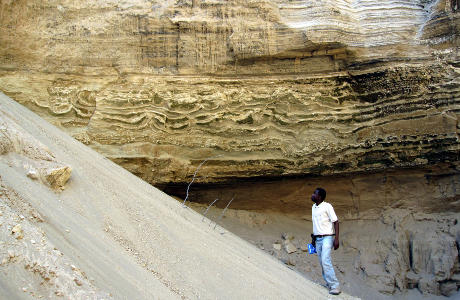
Geodynamics and mineral resources
By studying geological processes and mineralized systems we establish geodynamic models which shed light on, at multiple levels, fluid and material transfers and the concentrations of useful substances. We also try to grasp the social and environmental consequences of mineral resource extraction.
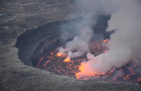
Natural hazards and Cartography
We combine fieldwork with geomatics techniques to study a range of hazards – including volcanic, seismic, water and landslides. We evaluate population, infrastructure and eco-systemic vulnerability for more efficient risk management.