African Geographic Pictures Collection
Search |
About the collection |
Practical guide |
Contact
| Image number: | 1808 |
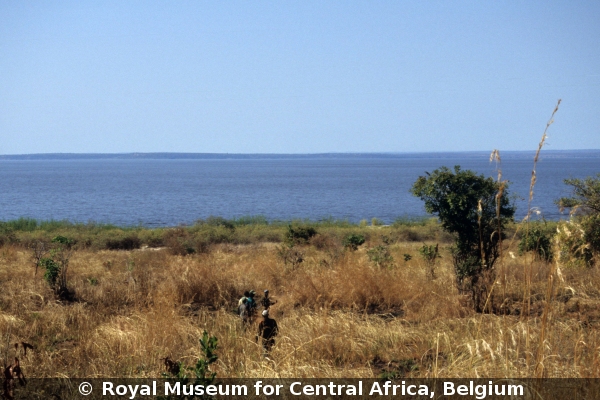
| Feature : | Lake Mweru-Wantipa |
| Grouping : | lakes, reservoirs, ponds and wells |
| Discipline : | hydrogeology |
| Year : | 2005 |
| Locality : | Kaputa |
| Country : | Zambia |
| Region - tribe : | Luapula - Luba |
| Physiographic region : | Northern Zambian Highlands |
| Notice : | Lake Mweru-Wantipa, Muzombwe game reserve post, view of the lake now with open waters. On the topographic maps of 1960's, it was restricted to the center of the depression, surrounded by swamps and mbuga (seasonal swamps). |
| Reference : | Delvaux de Fenffe, Damien, 2005 Image 1808. In : Moeyersons, Jan : "African Geographic Pictures", http://www.africamuseum.be/de/research/collections_libraries/earth_sciences/collections/geopic" |