African Geographic Pictures Collection
Search |
About the collection |
Practical guide |
Contact
| Image number: | 1832 |
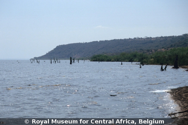
| Feature : | Lake Mweru-Wantipa |
| Grouping : | lakes, reservoirs, ponds and wells |
| Discipline : | geomorphology |
| Year : | 2005 |
| Locality : | Lake Mweru-Wantipa, Mikose village |
| Country : | Zambia |
| Region - tribe : | Luapula - Luba |
| Physiographic region : | Northern Zambian Highlands |
| Notice : | SE side le Lake Mweru-Wantipa. On the topo maps (1960), this lake is shown as a swamp (Wantipa means swamp in local language) bordered by mbuga plains (seasonal swamps). It has expanded considerably in the 1980's, due to lake level rise, flooding the fores that was occupying part of the lake floor. |
| Reference : | Delvaux de Fenffe, Damien, 2005 Image 1832. In : Moeyersons, Jan : "African Geographic Pictures", http://www.africamuseum.be/de/research/collections_libraries/earth_sciences/collections/geopic" |