African Geographic Pictures Collection
Search |
About the collection |
Practical guide |
Contact
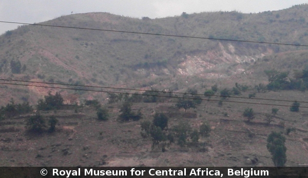
| Image number: | 2129 |
| Feature : | landslide |
| Grouping : | mass movements |
| Discipline : | geomorphology |
| Year : | 2007 |
| Locality : | Mulongwe - Kalimabenge |
| Country : | D.R.Congo |
| Region - tribe : | Uvira |
| Physiographic region : | Rift-Tanganyika |
| Notice : | The Mitumba Range between Mulongwe and Kalimabenge is affected by huge active landsliding. Look in the foreground to soil conservation measures with stone walls and terracing. This is the westerly extension zone of Uvira. |
| Reference : | Moeyersons, Jan, 2007 Image 2129. In : Moeyersons, Jan : "African Geographic Pictures", http://www.africamuseum.be/en/research/collections_libraries/earth_sciences/collections/geopic" |