Photographs of the expedition of Charles Lemaire (1898-1900)
Theme:
landscape, colonial administration, travel, exploration and research, nature
Place of production:
Democratic Republic of the Congo > Katanga
Legend:
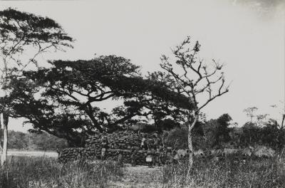
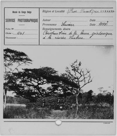
Lemaire carried out various geographic measurements during his expedition. He registered a total of 117 magnetic and 195 geographic positions, and an equal number of altitudes, during 265 evenings of careful observation. His measurement positions were marked with geodesic posts.
Acquisition related person:
Charles François Alexandre Lemaire (°1863 - †1925) as donor
Original legend:
Construction de la borne géodésique à la rivière Luakera.
Inventory number:
AP.0.0.1241