The collection of ancient maps
Title:
The collection of ancient maps
Producer:
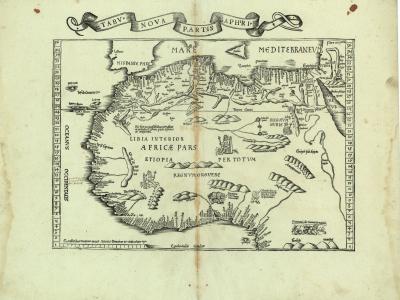
Laurent Fries
Legend:
In Pirckheimer’s 1535 edition of the ‘Geography’ one finds this first of two “modern” maps which Laurent Fries had copied from Waldseemüller’s 1513 edition. North and north-west Africa are well outlined, the result of mainly Portuguese exploration along the African coasts.
Place of production:
France > Lyon
Dimensions:
Map size: 27,8 cm x 40 cm / Paper size: 40,8 cm x 53,3 cm
Inventory number:
HO.1996.43.5