African Geographic Pictures Collection
Search |
About the collection |
Practical guide |
Contact
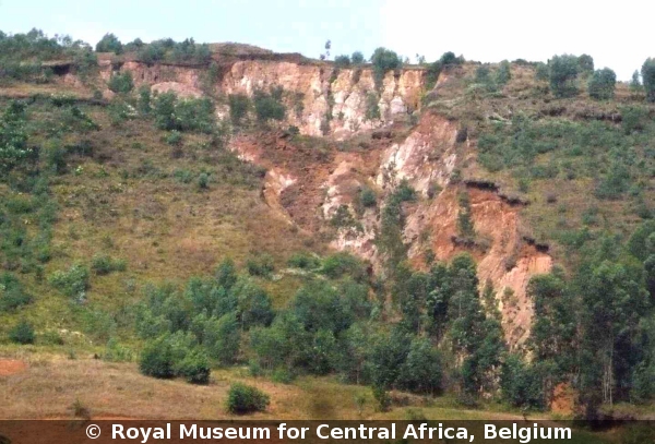
| Image number: | 2772 |
| Feature : | landslide |
| Grouping : | mass movements |
| Discipline : | geomorphology |
| Year : | 2010 |
| Locality : | Kibogoye-Muramvya |
| Country : | Burundi |
| Region - tribe : | Mugamba water divide |
| Physiographic region : | Rift-Tanganyika |
| Notice : | Landslide due to slope destabilisation due to laterite extraction. First movements have been noticed in 1985, five years after the start of the exploitation. Till today, this gully-like landslide continues to move slowly year by year. The road on the hill top has been destructed. Houses have been destructed. Natural hazard. Natural risk. The gully-like morphology is due to underground erosion - suffosion -. |
| Reference : | NIBIMPA Grégoire, 2010 Image 2772. In : Moeyersons, Jan : "African Geographic Pictures", http://www.africamuseum.be/de/research/collections_libraries/earth_sciences/collections/geopic" |