African Geographic Pictures Collection
Search |
About the collection |
Practical guide |
Contact
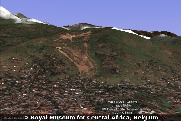
| Image number: | 2774 |
| Feature : | landslide |
| Grouping : | mass movements |
| Discipline : | geomorphology |
| Year : | 2011 |
| Locality : | Kandibula |
| Country : | D.R.Congo |
| Region - tribe : | Uvira |
| Physiographic region : | Rift-Albertine |
| Notice : | The Kandibula landslide as seen in 2011 from GoogleEarth. The landslide did develop as a result of wall instability of a huge gully. Now the landslide lobe is slowly progressing and threating the town of Uvira |
| Reference : | Google Earth, 2011 Image 2774. In : Moeyersons, Jan : "African Geographic Pictures", http://www.africamuseum.be/de/research/collections_libraries/earth_sciences/collections/geopic" |