RMCA publications
République démocratique du Congo. Tanganyika Espace fécondé par le lac et le rail. Désormais gratuitement disponible sur / Vanaf nu vrij beschikbaar op / From now free available on http://www.africamuseum.be/research/publications/rmca/online/index_html/
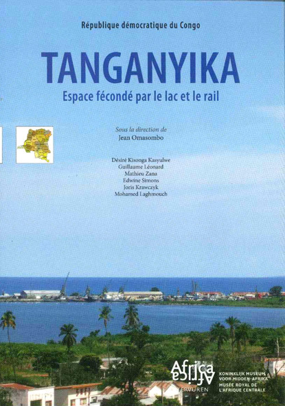
Son économie fut fécondée au cours du siècle dernier par l'union de l'eau et du fer. À partir du littoral qui borde tout le flanc oriental, les rails traversent l'intérieur du pays à la recherche du Lualaba qu'ils accrochent à hauteur de Kabalo, noeud ferroviaire qui assure la jonction avec le nord (Kindu, Maniema) et le sud (Kamina, Haut-Lomami). Le fleuve, justement, suppléé par le chemin de fer entre Kabalo et Kongolo, offre un bief navigable d'un seul tenant de plusieurs centaines de kilomètres à partir de Malemba-Nkulu (Haut-Lomami) jusqu'aux portes d'Enfer en aval de Kongolo. C'est autour de cette ossature progressivement aménagée jusqu'à la veille de l'indépendance, et à laquelle viendra se greffer un vaste réseau routier (environ 5 000 km), que se développèrent plusieurs secteurs d'activités économiques. Quelques fleurons industriels coloniaux s'implantèrent localement : le CFL ainsi que la Filtisaf à Albertville/Kalemie ; la Géomines à Manono ; la Cotanga à Kongolo ; etc. Par son port ouvert au centre et à l'est africain, un important commerce se développa également, en particulier le long du corridor Kigoma – Dar es Salaam. Région aux débouchés agropastoraux reconnus, c'est toutefois dans ce dernier domaine que fut davantage réputé le Tanganyika, par opposition au Sud minier.
Ainsi instruit rapidement de quelques-uns des caractères économiques spécifiques de la région, il serait tentant de glisser vers le politique et de voir a posteriori dans la courte expérience de la première décentralisation (1962-1967) le prolongement d'un particularisme régional. La carte des 22 provinces intégrée dans la Constitution du 1er août 1964 (dite de Luluabourg) reconnaît en effet l'existence d'une province du Nord-Katanga qui s'étend au Tanganyika et au Haut-Lomami pour regrouper les populations dites « lubaïsées », tandis que la scène politique est un temps dominée par l'action et l'image de la Balubakat, principal parti au nord de la province du Katanga. Mais loin de traduire une quelconque identité régionale, cet état est avant tout le fruit d'évolutions conjoncturelles : l'étude détaillée de cette période importante de l'histoire du district révèle, en fait, un terrain complexe, où s'entremêlent tensions entre unitaristes et fédéralistes, réflexes ethniques, calculs stratégiques, ambitions personnelles et luttes de pouvoir. La perspective d'un Katanga unifié dans un Congo centralisé restait globalement le but à atteindre, et l'on ne se résignait à l'idée de cette province construite de toute pièce qu'à titre temporaire, faute d'alternative pour neutraliser la sécession tshombiste ; c'est dire que l'entérinement ultérieur de la fragmentation de la province fut diversement apprécié par les responsables du Nord-Katanga. Depuis lors, l'expérience du pouvoir au plus haut niveau de plusieurs de ses ressortissants, à commencer par Laurent-Désiré Kabila, et les désillusions par rapport aux retombées attendues, ont engendré auprès de la population une nouvelle vision de la décentralisation : celle-ci pourrait être le chemin nécessaire vers la prise en main, par la base, de ses propres outils de développement.
À l'instar des parutions précédentes, cette monographie du projet « Provinces-Décentralisation » accorde une large place aux développements historiques, socio-administratifs, politiques et socio-économiques. Elle entend toutefois offrir une analyse et un état des lieux des connaissances qui ne se limitent pas à ces seuls aspects : tant les sciences naturelles (faune, végétation, hydrologie, géologie, géographie) que d'autres secteurs des sciences humaines (anthropologie, musicologie) participent, ici, à une meilleure connaissance du Tanganyika, dans la richesse et la complexité de ces multiples dimensions.
***
Heel vroeg al wekt de Taganyika-regio de nieuwsgierigheid op van westerse en Arabische geleerden op zoek naar de bronnen van de Nijl. Ze strekt zich uit over een oppervlakte van ongeveer 135 000 km, of bijna 6 % van het nationale territorium, in een gebied dat zich ruwweg bevindt tussen de Lomami-Lualaba bergkam in het westen, een rotsachtige heuvel in het oosten en in het zuiden de Kamalondo-depressie en de barrière van drie meren: Moëro (noordelijke punt), Mweru Wantipa (Republiek Zambia) en Tanganyika (onderaan). Alleen de noordelijke grens die langs de 5e graad zuiderbreedte loopt, van de kruising met de Kiangwe-rivier tot de oostelijke grens van de DR Congo, lijkt helemaal geen rekening te houden met natuurlijke omstandigheden.
De economie van de regio kreeg een boost in de voorbije eeuw door de samensmelting van water en ijzer. Vanaf de kustlijn langs de hele oostelijke flank, doorkruisen de spoorrails het binnenland, op zoek naar de Lualaba, die ze vinden in Kabalo, het knooppunt van het spoornet dat zorgt voor de verbinding met het noorden (Kindu, Maniema) en het zuiden (Kamina, Haut-Lomami). De rivier zelf, die vervangen werd door de spoorweg tussen Kabalo en Kongolo, dient als bevaarbaar kanaal dat aan een stuk bevaarbaar is over honderden kilometers, vanaf Malemba-Nkulu (Haut-Lomami) tot de Portes d'Enfer watervallen stroomafwaarts van Kongolo. Tot op de vooravond van de onafhankelijkheid nam deze structuur geleidelijk vorm aan en er werd een uitgebreid wegennetwerk (ongeveer 5000 km) aan toegevoegd. Hierrond ontwikkelden zich meerdere sectoren van economische activiteit. Enkele pronkstukken van de koloniale industrie werden lokaal ingeplant: CFL en Filtisaf in Albertville/Kalemie; Géomines in Manono; Cotanga in Kongolo, enz. Via de haven die open stond voor het centrum en voor oostelijk Afrika, ontwikkelde zich ook een belangrijke handel, in het bijzonder langs de Kigoma-Dar es Salaam corridor. Het is precies door deze maritieme handel dat Tanganyika, ondanks zijn alomgekende agropastorale afzetmogelijkheden, een grotere reputatie verwierf, dit in contrast met het zuiden, waar de aandacht zich toespitste op mijnbouw.
Met dit kort overzicht van enkele specifieke economische karakteristieken van de regio in het achterhoofd, is het verleidelijk ook de politiek hierbij te betrekken en a posteriori de korte periode van de eerste decentralisatie (1962-1967) te zien als het doortrekken van een regionaal particularisme. De grondwet van 1 augustus 1964 (de zogenaamde Luluabourg-wet), waarin de kaart van de 22 provincies was geïntegreerd, erkent immers het bestaan van een provincie Nord-Katanga, die zich uitstrekt naar Tanganyika en naar Haut-Lomami en die de ‘Gelubaïseerde' bevolkingsgroepen samenbrengt, terwijl op het politieke vlak de Balubakat, de leidinggevende partij in het noorden van de provincie Katanga een tijdlang de plak zwaait. Deze situatie is niet zozeer de weerspiegeling van een regionale identiteit maar eerder het resultaat van conjuncturele evoluties. Een gedetailleerd onderzoek van deze belangrijke geschiedkundige periode van het district, legt in feite een complexe situatie bloot, waarin spanningen tussen unitaristen en federalisten, etnische reflexen, strategische berekeningen, persoonlijke ambities en machtsspelletjes met elkaar verweven zijn. Het perspectief van een eengemaakt Katanga in een gecentraliseerd Congo bleef in het algemeen het te bereiken doel en de spelers aanvaardden het idee van deze uit het niets opgericht provincie enkel als een tijdelijke maatregel, bij gebrek aan een beter alternatief om de secessie, onder leiding van Tshombe te neutraliseren. Het valt dan ook niet te verwonderen dat de Noord-Katangese autoriteiten de latere bekrachtiging van de fragmentatie van de provincie met gemengde gevoelens ontvingen. Sindsdien hebben de machtswissels van verschillende onderdanen van het gebied – te beginnen met Laurent Désiré Kabila – en de niet ingeloste verwachtingen, bij de bevolking een nieuwe visie gecreëerd rond de decentralisatie: het zou dé manier kunnen zijn om, vanuit de basis, hun eigen ontwikkeling in handen te nemen.
***
From an early time, the Tanganyika region piqued the curiosity of Western and Arab scholars who were eager to identify the sources of the Nile. The region covers nearly 135,000 km², or a little under 6% of the country's total territory, in an area roughly located between the Lomami-Lualaba ridge line to the west, a rocky swell to the east, and, in the south, the Kamalondo depression and the barrier of lakes Mweru (northern point), Mweru Wantipa (Republic of Zambia), and Tanganyika (bottom). Only the northern limit running along the 5th parallel south, from the intersection with Kiangwe river to the eastern border of DR Congo, appears to disregard natural circumstances completely.
Its economy was boosted in the previous century by the union of water and iron. From the coastline of the entire eastern side, railway tracks crossed the landbound portion of the country, in search of the Lualaba river, and meeting it at Kabalo, the junction of railway lines between the north (Kindu, Maniema) and south (Kamina, Haut-Lomami). The river itself, replaced by the railway between Kabalo and Kongolo, offers a navigable channel stretching over several hundred kilometres from Malemba-Nkulu (Haut-Lomami) to the Portes d'Enfer falls downstream from Kongolo. This structure progressively developed, along with a vast road network (around 5,000 km) connected to it, until the eve of independence. Several economic sectors grew around this framework. Some of the gems of colonial industry established themselves locally: CFL and Filtisaf in Albertville/Kalemie; Géomines in Manono; Cotanga in Kongolo; etc. Significant trade also grew via its port which connected to the centre and east of Africa, especially along the Kigoma–Dar-es-Salaam corridor. Tanganyika became especially known for its maritime trade, in contrast with the mining areas of the south, even though the region also favoured the agro-pastoral economy.
Given this brief overview of a few economic characteristics specific to the region, it is tempting to shift to politics and, in hindsight, view the short experience of the first decentralisation (1962-1967) as an extension of a regional peculiarity. The map of the 22 provinces included in the Constitution of 1 August 1964 (known as the Luluabourg constitution) recognized the existence of a province of Nord-Katanga that stretched to Tanganyika and Haut-Lomami to cover the so-called "Luba-ised" peoples, while the political scene was dominated for a while by the work and image of the Balubakat, the leading party in the north of Katanga province. But rather than reflecting a given regional identity, this situation is above all the result of situational developments. A detailed analysis of this important period in the district's history shows a complex situation, where tensions between unitarists and federalists, ethnic reflexes, strategic calculations, personal ambitions, and power struggles all mingled. The prospect of a unified Katanga in a centralised Congo remained the general objective, and the players only accepted the notion of this province created from scratch as a temporary measure, as there was no better alternative for neutralising the Tshombe-led secession. Unsurprisingly, Nord-Katanga officials had mixed reactions to subsequent moves to break up the province. Since that time, with the accession to the highest levels of power by several of its natives, beginning with Laurent-Désiré Kabila, and the actual benefits of this falling short of the initial hopes of locals, the population adjusted their view of decentralisation: it could well be the path they needed to follow in order to take charge of their own development.
Like its predecessors, this monograph of the ‘Provinces-Decentralisation' project devotes a large portion to historical, socio-administrative, political, and socio-economic developments. It nonetheless seeks to provide an analysis and survey of knowledge not limited to these aspects alone. Discussions of its nature (fauna, vegetation, hydrology, geology, geography) and other areas of human science (anthropology, musicology) all contribute to a better understanding of Tanganyika, in the wealth and complexity of these many dimensions.
 Freely available at this link