Staff directory

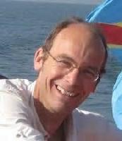
François Kervyn de Meerendré

Information
François Kervyn de Meerendré
Department: Earth Sciences
Division: Natural hazards
Job Title: Head of service
Specialisms: Optical and radar remote sensing, GIS, volcanic and seismic hazards
Email: francois.kervyn.de.meerendre@africamuseum.be
Phone: 32 2 769 5433
Education

Ph.D. in Sciences (June 2001), Geology. Catholic University of Louvain. Belgium

M.Sc. and B.Sc. in Geology (June 1993). Catholic University of Louvain. Belgium

Career

01/02/2011–Present Head of Natural Hazards Unit - Royal Museum of Central Africa (RMCA)
Leading and coordination of the unit activities:
* Scientific research projects
* Scientific activities related to cartographic archives valorization
* Collection management and development
* Public-oriented services and scientific expertise
Field of activity: Natural hazards / Remote sensing / GIS
Sector: Federal Research Institution

01/03/2010–31/01/2011 Research Assistant - Royal Museum of Central Africa (RMCA)
Support to the unit activities:
* Leading valorization of scientific work
* Identifying strategies for the Unit development
Field of activity: Natural hazards / Remote sensing / GIS
Sector: Federal Research Institution

2009 - 2010 Consultancy in GIS for various EU-funded development projects in DR Congo
consultancy tasks :
* Developing methodologies for the mapping of health structures in South-Kivu province (Bukavu - DR Congo)
* Training of the provincial office health experts in data collection and processing in GIS (Bukavu - DR Congo)
* Processing health data for the Ministry of Health (Kinshasa - DR Congo)
* Contribution to a workshop with WHO and DRC Ministry of Health. Theme: Health sector cartography in DRC (Kinshasa - DR Congo)
* Training of trainers in GIS data preparation methodologies and spatial data analysis (Goma - DR Congo)
* Training of the Ministry of Health staff to spatial data processing: methodological aspects and GIS (Kinshasa - DR Congo)
Field of activity: GIS
Sector: Development Cooperation

14/01/2010–26/01/2010 Scientific collaborator - Royal Museum of Central Africa (RMCA)
Tasks:
* Support to the monitoring of the Nyamulagira volcano eruption (DR Congo)
* Implementation of a GIS architecture for the Goma Volcano Observatory
Field of activity: GIS & remote sensing
Sector: Federal Research Institution

01/07/2007–31/10/2009 Project Manager - SODERU NGO/EU-funded project
Job location: Goma (DR Congo)
responsibilities:
Setup of a Geographic Information Center in Goma:
* Project Management
* Equipment acquisition and installation
* Staff recruitment
* Staff training
* Data gathering from EU-funded partners
* Setup of a geodatabase

01/07/2001–30/11/2002 Postdoc research - Ecole et Observatoire des Sciences de la Terre (EOST), Strasbourg (France)

Awards

Laureate of the Lucien Cahen Prize (Royal Academy for Overseas sciences), 2003

Research

François Kervyn is a remote sensing geologist with a focus on the use of SAR techniques for natural hazards research applications. He has a strong background in GIS and developped his field experience in various African countries (Tanzania, Rwanda, DR Congo, Burundi, Uganda).
Since 2005, he has been involved in 9 research projects -7 as leader-, and 11 service-oriented projects -9 as leader-. Since 2011, François Kervyn is leading the Natural Hazards unit of the Earth Sciences Department from the Royal Museum for Central Africa. His main research interests are in the field of the use of remote sensing techniques for the study of natural hazards in Central Africa, and the related risks for the society (GeoRiskA research group).
He develops research activities in close collaboration with scientific partners in Africa and promotes their parallelization with the strengthening of the local expertise (training sessions & programs).
His managing tasks also include the valorization of the archives hosted in the map library of the department (>20.000 maps and >300.000 aerial photos).