Projects
GuiDANCE
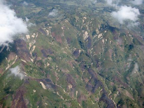
Africa today faces multiple challenges involving economic development, population growth, environmental issues, and climate change, to name but a few. Faced with these challenges, rapidly expanding cities in Africa generate large concerns in terms of the increasing impacts of geohazards such as landslides, volcanic eruptions, earthquakes, local subsidence, ground collapse and gully erosion. Although significant progress has been made in establishing institutions and regulations for risk reduction in Sub-Sahara Africa over the last 10 years, knowledge on hazards and capacities to design and implement adequate risk reduction remains extremely limited. The short term (5 years) general scientific objective of this FED-tWIN project is to gain insight into baseline patterns/rates of geohazards in urban sprawling contexts. The research will focus on the study of geohazard patterns/rates that occur under natural conditions as well as the way in which humans have affected these processes or their exposure to these processes therefore increasing the level of risk. The specific objectives are (1) estimating the surface distribution of ground deformations associated to geohazards in Sub-Saharan urbanized contexts; (2) documenting active geohazard processes using a range of techniques to identify the most suitable strategies for operational monitoring of these events using a combination of data (ground-, air- and space-borne)/platforms and analytical techniques; (3) exploring the interplay between natural (climatic, geomorphologic, seismic conditions) and human-induced parameters (urban expansion, urban infrastructure, land use change) controlling the dynamics and frequency-magnitude relations of these processes in these environments. The long-term scientific objective (10 years) is to develop specific expertise in the field of remote sensing and geohazards in Africa and with Africans around a strong collaboration between the VUB Department of Geography and the RMCA Department of Earth Sciences to tackle the challenges related to Disaster Risk Reduction. The project builds upon the unique existing expertise and networks of collaborators of both institutions. During the first two years of the project, the FED-tWIN researcher will get familiar with new techniques and skills that he/she is expected to master (additional to the ones he/she already has experience with); capitalising on RMCA/VUB expertise in the key techniques to be used. The recent advent of high frequency satellite data acquisition (e.g. Sentinel-1 and -2, Planet imagery) opens the scope for systematic data analysis for a large series of urban targets using state-of-the art methods. Radar remote sensing techniques are a priority method for the FED-tWIN candidate. A key aspect will also be the integration of the RMCA collection of historical aerial photographs in the research, as it has the potential to reveal key information on the state of the environment from the mid of the 20th century till today. It is expected that the FED-tWIN researcher becomes a leader in his/her field with a large autonomy developing new synergies, partnerships, external project funding, and student (PhD and MSc) supervisions. These key challenges are in line with the current R&D strategies of the two institutions.