Natural hazards and Cartography
Our research focuses on:
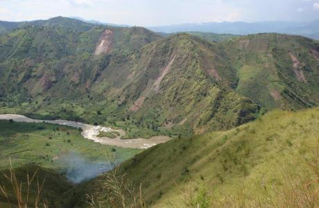
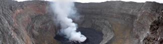
- compiling an inventory of hazards of geological and geomorphological origin: volcanoes, seismic events and landslides, particularly in Central Africa
- analysing these hazards and how they relate to geodynamic processes
- studying the temporal and regional variability of these phenomena
- assessing the vulnerability of populations and infrastructure, and the risks associated with these hazards
- developing and using satellite methods and Geographic Information Systems (GIS) tools for spatial analysis and modelling.
Our activities are based on a strong network of African partners.
- Staff
-
Scientific personnel
- François Kervyn de Meerendré, Head of service
Optical and radar remote sensing, GIS, volcanic and seismic hazards - Mercy Ashepet, Social biologist
citizen science, snail-borne diseases, natural harzard, surveys, Focus group discussions - Arthur Depicker
- Olivier Dewitte, Physical geographer
Geomorfologie, natuurlijke gevaren, milieuverandering, terrein, capaciteitsopbouw - Antoine Dille, Physical geographer
- Mohamed Laghmouch, Cartographer
GIS, cartography, optical remote sensing - Caroline Michellier, Geographer
Natural hazards, vulnerability, GIS, awareness tools, fieldwork, capacity building - Pascal SIBOMANA
- Benoît Smets, Geologist
Remote sensing, GIS, volcanic hazards
Technical and administrative staff
- Evelyne Gilles, "Chemical technician and collection support"
Map library maintenance - Suzanne Minon, Secretary
Volunteers
- François Kervyn de Meerendré, Head of service