Projecten
GEOTROP
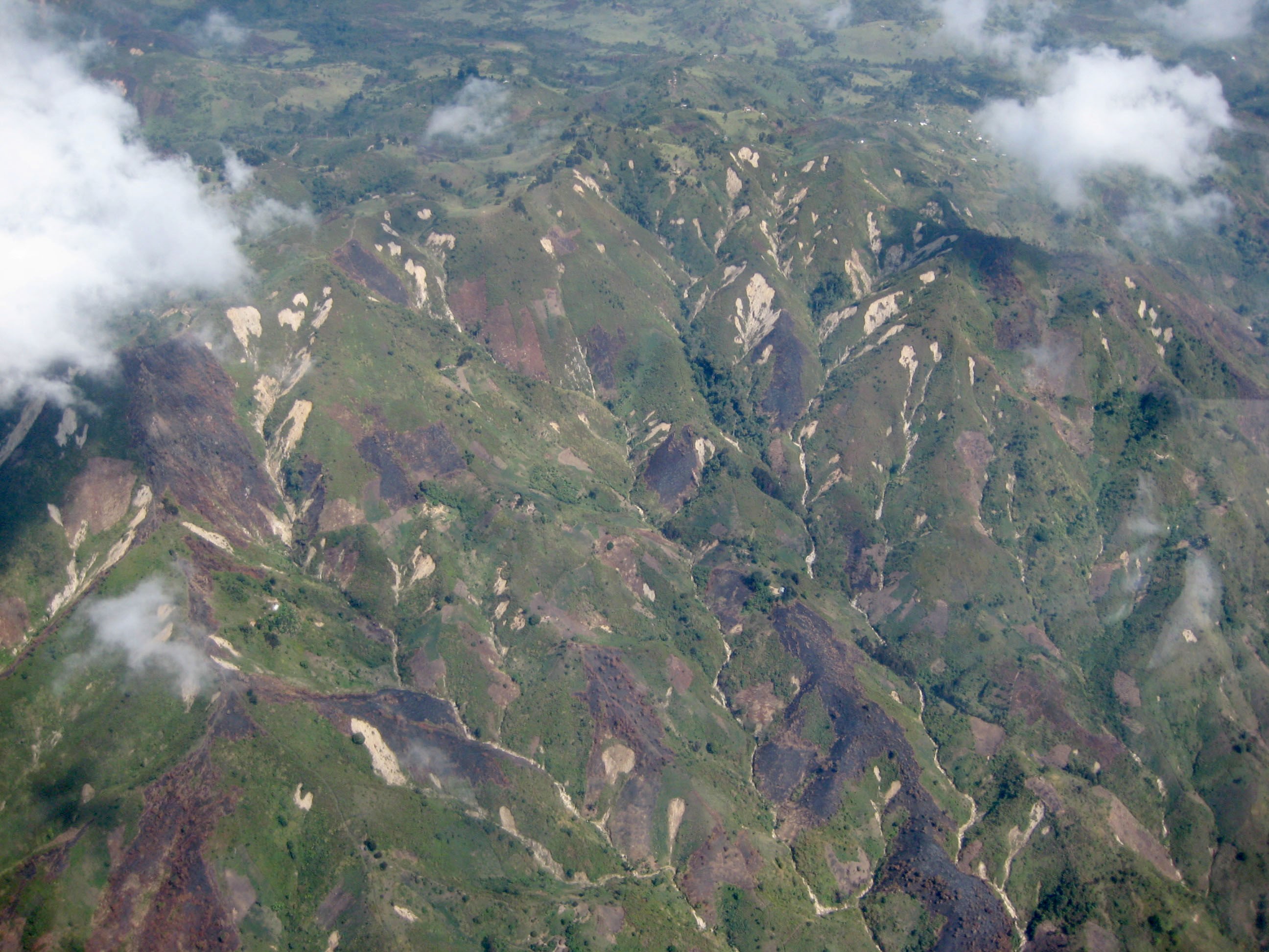
Landslides and flash floods are geomorphic hazards (GH) that often result from a combination of interacting processes across multiple spatial and temporal scales. GH events are linked to climate drivers (e.g., rainfall intensity) and land drivers (e.g., vegetation patterns). Land transformation such as deforestation has impacts on GH events and climate change will alter many drivers. The tropics are environments where GH are under-researched. In mountainous regions, high population densities with high societal vulnerability are common, frequently on the rise. GH events disproportionately impact these regions. In the future, the frequency and/or impacts of GH events will be more severe; not only due to, for example, climate change and deforestation, but also due to population growth and increased exposure to disasters. In many instances, landslides and flash floods occur very quickly. Landslides and flash floods frequently co-occur and interact, leading to events with more severe impacts. The combination of processes (climate drivers and/or hazards) leading to a significant impact is referred to as a ‘compound event’. Although many GH can be assumed to be caused by compound events, the understanding, analysis, quantification and prediction of such events is still in its infancy, especially at a regional level. GEOTROP aims to assess the role of land transformation and climate change on the occurrence of GH compound events in tropical East Africa.
The specific objectives (SO) are:
- SO1: To develop an unprecedented spatio-temporal regional inventory of GH events;
- SO2: To understand the spatial distribution of the GH events in the landscape, and to assess the role of land transformation on their occurrence (location of GH events);
- SO3: To uncover the interplay of multiple land and climate drivers in triggering GH compound events (timing of GH events)
- SO4: To project the future evolution of GH compound events so that future hazard and risk hotspots can be identified.
- SO5 aims to strengthen capacities of African institutions involved in disaster risk reduction (DRR).
GEOTROP focusses on the western branch of the East African Rift. Satellite remote sensing approaches will allow to obtain high accuracy constraints on the timing of GH events over this large region. Since cloud-covered conditions are pervasive in such tropical environments, the timing characterization is achieved through the combined use of optical and radar remote sensing. The spatio-temporal analysis of the detected GH events will be done with Earth observation measurements for the study of global change and harmonised climate and LULC change scenarios. GEOTROP relies on high performance computing and cloud-computing infrastructures to process these very large datasets. Information from citizens will be used for validating the methods and improving the processes characterization. This project will improve our understanding of natural hazards in the context of global change in under-researched climates. It is innovative for developing better hazard zonation and DRR strategies in the region, and also for understanding the evolution of the landscapes and its dangers in general. The project combines innovative tools and approaches in Earth observation and climate science for working on unprecedented large regional scales.
Hoofdonderzoeker:
Datum:
2022 2025Medewerkers:
Externe partners:
Wim Thiery (VUB - Belgium)Nicolas d'Oreye (NMHH/ECGS - Luxembourg)
Jean-Philippe Malet (CNRS/EOST France)
Jakob Zscheischler (UFZ - Germany)