Projecten
GeoRisCA
GeoRisCA (2012-2016) is a scientific project funded by the Belgian Federal Scientific Policy (Belspo).
The main objective is the assessment of the georisk in the Kivu region (DRC, Rwanda, Burundi), by analysing and combining seismic, volcanic and mass-movement hazards as well as the vulnerability of the population, the infrastructures and the natural ecosystems, in order to support risk management.
The project is coordinated by the Royal Museum for Central Africa, in collaboration with the Université Libre de Bruxelles, the Université de Liège, the Vrije Universiteit Brussel and the European Center of Geodynamics and Seismology. It is conducted in close collaboration with local partners from the three targeted countries (Burundi, DRC and Rwanda).
Context and theory
The region of interest corresponds to the centre of the western branch of East African rift valley extending from North Tanganyika region to the Virunga Volcanic Province (VVP). That densely populated area is affected by a combination of several types of geohazards.
The region is characterized by a strong seismicity (800 “felt seisms” between 1909 and 1954 in DRC, Rwanda and Burundi; the greatest historical known earthquakes in East Africa, in terms of magnitude, recorded close to the studied region). Recently, moderate magnitude earthquakes have hit the Kivu basin area and caused important damages and casualties (e.g. 2008 Bukavu-Cyangugu Mw 5.9). Due to the demographic increase, more and more people and infrastructures are exposed to the seismic risk in these regions.
The dormant volcanoes in the Eastern part of the VVP represent a potential threat but require more assessment. The region also hosts the two most active volcanoes of Africa: Nyiragongo and Nyamulagira. Their activities have serious impacts on the environment (e.g. 927 ha of tropical primary forest devastated during the 2010 Nyamulagira eruption). Its neighbour, the Nyiragongo volcano, hosts a (semi-) permanent ~200 m wide lava lake, the largest on Earth. In Africa, this volcano is also probably the most dangerous to human beings as it directly threatens the ~700.000 inhabitants of Goma city, which is located ~15 km south. In January 2002, such as in 1977, fissures opened on the southern flank of the volcano and fast lava flows destroyed about 10 % of the city, killed nearly 150 persons, made 100.000 people homeless and triggered a humanitarian crisis. The long-term socio-economic impact is still felt nowadays. Goma is a strategic economic centre for the Great Lake Region and its population is growing rapidly, also due to the important displaced populations that settle in camps during conflicts. In addition, the high concentration of volcanic CO2 gas dissolved in the lake Kivu water could potentially lead to a limnic eruption, i.e. a brutal gas release leading to massive casualties by asphyxiation in the whole region (e.g. lake Nyos in Cameroun in 1986). A sub-lacustrine magmatic eruption or a major landslide are considered as possible trigger mechanisms for a lake overturn. The passive volcanic degassing causes CO2 accumulation in on-land depressions up to lethal concentration, called mazuku. That hazard is observed in many areas along the northern shore of Lake Kivu including Goma and Sake urban centers where it represents a serious danger to the population and cattle.
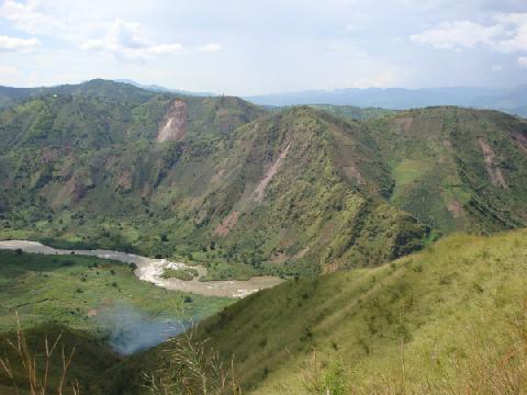
Throughout the targeted region, landslides – mass movement of a portion of the slope or the slope itself (soil or rock) – represent the most severe hazard at local scale. A chronological and spatial inventory of geologic/geomorphic events that occurred in the DRC, Rwanda and Burundi since 1900 is shown by the on-line database compiled by the RMCA. In the study area, mass movements can be triggered both by climatic events (strong rainfall) as well as seismic or volcanic activity. The potential impact of these landslides is increased by anthropogenic factors. In cities such as Bujumbura and Uvira, for instance, both the rift escarpment and the Lake Tanganyika limit urban expansion, forcing people to settle on unstable slopes.
Such disasters, unforeseen and often sudden events, are the result of the spatial conjunction of a hazard and vulnerable stakes (people, assets, lifelines, activities) in a given place and time. It is fundamental to try assessing the probability of occurrence of a disaster (i.e. the risk). Vulnerability is measured through the exposure to perturbations and the adaptive capacity or resilience of the vulnerable systems.
An added value of GeoRisCA is to develop a methodology to assess the vulnerability to multi geohazards within the studied area at regional and at local scale, for selected urban sites, considering the evolution of vulnerability through time, e.g. due to improved education, increased income, denser social networks and evolution of coping mechanisms.
The risk assessment is influenced by an additional factor: the risk perception. People's behaviour when facing a danger are not only influenced by the socio-economic context, but also by their hazard knowledge, the role of political institutions and the role of religion. In summary, people with the higher risk perception are likely to be best prepared in the event of a disaster.
Objectives
The main objective is the assessment of the georisk in the Lake Kivu region (DRC, Rwanda, Burundi), by analysing and combining seismic, volcanic and mass-movement hazards as well as the vulnerability of the population, the infrastructures and the natural ecosystems, in order to support risk management.
Most threatening at regional scale are the seismic hazard and the regular eruptions of the two active volcanoes of the Virungas that could strongly affect this high densely populated and vulnerable area. Possible impacts of lethal gas in certain area around Goma city, and the large number of reported and forecasted mass movements, as well as site-specific seismic amplification effects increase the danger at local scale.
GeoRisCA assessment will take the form of dynamic maps and databases based on a comprehensive methodology.
The local and regional authorities, as well as local and international stakeholders, will benefit from essential documents to (1) develop more efficient disaster response mechanisms and (2) help them improve land planning and the implementation of development programs.
Specific objectives:
- contribute to a better assessment of the targeted geohazards at regional scale and in specific areas, such as urban context;
- evaluate the global vulnerability of populations to these geohazards, a study which has never been undertaken in that region, although more than 3 millions of people live in the region under study;
- develop a risk assessment methodology, which will allow to rapidly obtain a updated risk portrait of a specific area when needed;
- deliver a series of regional and local risk maps presenting a large number of hazards and vulnerability indicators that should help decision-making;
- enforce risk management processes through communication of the results with existing preparedness and mitigation institutions, as well as authorities and other concerned organisations.
Methodology
An innovative approach based on the integration of various scientific methodologies is developed in GeoRisCA. Methods from geology, geophysics, geomorphology, geography, and anthropology are associated in order to provide a realistic image of the risk in the target region.
The developed methodology at the local scale combines hazard and vulnerability factors, as well as risk perception indicators. The collected quantitative and qualitative data are standardised and compiled into a Geographical Information System (GIS) according to a specific weighting.
The precise methodology is based both on the literature and on the advice of experts of risk assessment and local stakeholders.
The risk assessment is defined at the regional and local (urban) scales; moreover, GeoRisCA provides an evolving picture of the risk level, by taking into account the variations of the geohazards and the vulnerability factors and the coping mechanisms that people developed in order to face geohazards.
A series of maps as decision-making tools will be produced, highlighting various aspects of the risk, depending on the hazards type, the scale and the potential use.
Expected results
GeoRisCA addresses the geo-risk globally at both regional and local scales. As such, it represents an innovative approach for that area characterized by a high population density and a superimposition of multi-hazards layers.
One of the main outputs of the project will be to develop methodology that:
- takes into account the assessment of the significant geohazards
- evaluates the global vulnerability of populations to those hazards
- can be integrated into risk assessment and decision making processes where it can be dynamically modified and adapted to the situation to obtain an updated risk portrait for a specific area. This involves (1) the definition of the various significant hazards parameters as one of the outputs and (2) the definition of the vulnerability and risk perception indicators as another major output.
Deliverable output results
Given the spatial dimension, the expected important amount of multi sector and societal data, the project will generate various deliverables under the form of GIS layers, thematic maps, databases, and tools to exploit them all in the perspective of an improved risk assessment.
Hoofdonderzoeker:
Datum:
2012 2016Medewerkers:
Externe partners:
Dr. H.B. HavenithDr. N. d'Oreye
Dr. E. Wolff
Dr. M. Kervyn
S. Poppe
S. Draidia